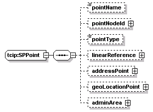
diagram | ![]() |
||||||||
type | lrms:Text-name255 | ||||||||
properties |
|
||||||||
facets |
|
||||||||
source | <xs:element name="pointName" type="lrms:Text-name255" minOccurs="0"/> |
diagram | ![]() |
||||||||
type | lrms:IdType | ||||||||
properties |
|
||||||||
children | intOrAlpha databaseID | ||||||||
source | 
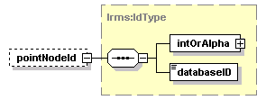
<xs:element name="pointNodeId" type="lrms:IdType" minOccurs="0"/> |
diagram | ![]() |
||||||||
type | lrms:PointType | ||||||||
properties |
|
||||||||
source | <xs:element name="pointType" type="lrms:PointType" minOccurs="0"/> |
diagram | ![]() |
||||||||
type | tcip:SPLink | ||||||||
properties |
|
||||||||
children | name info begin-lat begin-lon end-lat end-lon dist-along side points | ||||||||
source | 
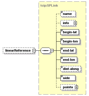
<xs:element name="linearReference" type="SPLink" minOccurs="0"/> |
diagram | ![]() |
||||||||
type | lrms:AddressPoint | ||||||||
properties |
|
||||||||
children | structureNumber streetInfo side height adminAreas | ||||||||
source | 
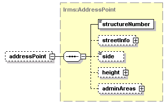
<xs:element name="addressPoint" type="lrms:AddressPoint" minOccurs="0"/> |
diagram | ![]() |
||||||||
type | lrms:GeoLocation | ||||||||
properties |
|
||||||||
children | latitude longitude horizontalDatum height | ||||||||
source | 
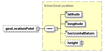
<xs:element name="geoLocationPoint" type="lrms:GeoLocation" minOccurs="0"/> |
diagram | ![]() |
||||||||
type | lrms:AdminAreaGroup | ||||||||
properties |
|
||||||||
children | city county state postalCode countryCode stateFIPS entityIPS countyFIPS cityFIPS localAdminAreaGroup | ||||||||
source | 
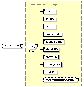
<xs:element name="adminArea" type="lrms:AdminAreaGroup" minOccurs="0"/> |