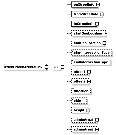
| elements | lrms:CrossStreets/crossStreetsLink lrms:LinkLocation/crossStreetsLink |
<xs:sequence>
<xs:element name="onStreetInfo" type="StreetInfo"/>
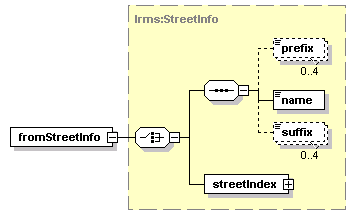
<xs:element name="fromStreetInfo" type="StreetInfo"/>
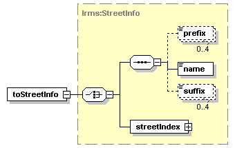
<xs:element name="toStreetInfo" type="StreetInfo"/>
<xs:element name="startGeoLocation" type="GeoLocation" minOccurs="0"/>
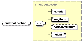
<xs:element name="endGeoLocation" type="GeoLocation" minOccurs="0"/>
<xs:element name="startIntersectionType" type="IntersectionType" minOccurs="0"/>
<xs:element name="endIntersectionType" type="IntersectionType" minOccurs="0"/>
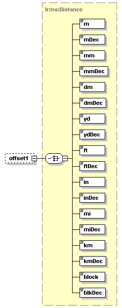
<xs:element name="offset1" type="Distance" minOccurs="0"/>
<xs:element name="offset2" type="Distance" minOccurs="0"/>
<xs:element name="direction" type="Direction" minOccurs="0"/>
<xs:element name="side" type="Side" minOccurs="0"/>
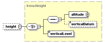
<xs:element name="height" type="Height" minOccurs="0"/>
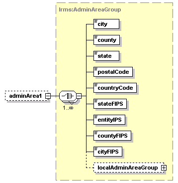
<xs:element name="adminArea1" type="AdminAreaGroup" minOccurs="0"/>
<xs:element name="adminArea2" type="AdminAreaGroup" minOccurs="0"/>
</xs:sequence>
</xs:complexType>